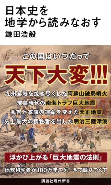
・What is the most common volcano in Japan is a “vulcano type” eruption where highly calm magma erupts explosively, an eruption with high risk because cinder stones and volcanic ash are vigorously jumping out of processing, and eruptions where less sticky magma rises high in the sky like Feng Shui from processing are called “strombolian” and are occasionally seen in Japan, and lava that flowed out due to low calm reaches the foot quickly; basically, it is an explosive eruption Since there are none, it is a relatively safe type of eruption (p51)
・From around 20 million years ago, the Sea of Japan continued to expand east-west, and the Japanese archipelago moved away from the continent, and in the process, an event occurred where the Japanese archipelago bent into an “inverted shape” like today. The part corresponding to present-day western Japan rotated clockwise from around 15 million years ago, and conversely, the part corresponding to eastern Japan began to rotate counterclockwise. Thus, the prototype of the current Japanese archipelago was formed (p65) when bent, a large groove was formed between Tohoku Japan and southwest Japan, and this is “Fossa Magna” (p66)
・ In 1991, the definition of an active volcano was updated to “a volcano that erupted within about 2000 years in the past and a volcano that currently has active fumarolic activity,” and in 2003 it also included the possibility that the eruption will resume for the first time in thousands of years, and it was updated to the definition that it erupted within 10,000 yen in the past (p73)
・The first massive eruption of Mount Aso was not 90,000 years ago; it is known that massive eruptions occurred about 270,000 years ago, about 140,000 years ago, and about 130,000 years ago; together, the 4 eruptions are called the “Aso 4 eruptions” (p75)
・In addition to Aso, Aira (Kagoshima Prefecture), and Onikai (Kagoshima Prefecture), where there are 8 giant caldera volcanoes that were formed 100,000 years ago and are likely to be active in the future, they are Kussharo, Shikotsu, Toya, Towada, and Ada (Kagoshima Prefecture) (p89)
・As cooling progressed, the sea level dropped and the coastline that had penetrated deep inland retreated, and as a result, plains expanded in various parts of Japan, this has great significance in Japanese history, many flat lands suitable for rice cultivation were born, rice cultivation in paddy fields began in Japan around the 6th century BC, the Jomon period centered on hunting and gathering ended, and the Yayoi period centered on rice cultivation began (p95)
・The reason earthquakes and eruptions occur frequently now is because they are trying to gradually resolve the distortion applied to the ground by “3.11,” and the Japanese archipelago has begun an “era of global change” for the first time in a thousand years, so earthquakes and eruptions will not stop for the next few decades (p100)
・The Nankai Trough earthquake is an earthquake with the epicenter area in the Nankai Trough formed by the Philippine Sea plate sinking into the Eurasian plate, and the epicenter area that causes massive earthquakes can be broadly divided into three parts in the long east-west Nankai Trough. It is called the “Tokai earthquake,” “Tonankai earthquake,” and “Nankai earthquake” depending on whether an earthquake occurred in the epicenter area of (p107)
・In the Jogan eruption of Mt. Fuji, a long crack spanning 6 km long formed at the northwest foot of Mt. Fuji, and a large amount of lava flowed out from there, the lava burned down the forest that was there at the time, and then the central part that flowed into the large lake that was there at the time was reclaimed and divided into two east and west lakes; these are “Lake Saiko” and “Lake Shoji,” where plants gradually grew in the area (lava plain) where lava was burned down and became a primeval forest “Aoki-ke” It's “Primeval Forest Sea” (p113)
・The first major eruption since UC occurred at Mt. Nasu in the northern part of Tochigi prefecture in 1410, then Mt. Nasu entered a quiet period again, and the next eruption was in 1846, about 400 years later (p126)
・The Tensho earthquake in January 1586 can be said to be an earthquake that changed Tokugawa Ieyasu's fate; Hideyoshi was preparing to shoot Ieyasu who didn't listen to him; Tensho himself occurred at that time, and Ogaki Castle, which was a front base for defeating Ieyasu in Mikawa, was completely destroyed, and Hideyoshi himself experienced a major tremor at Sakamoto Castle on the shores of Lake Biwa and fled back to Osaka. Hideyoshi, who was no longer at war due to damage from the earthquake, stopped defeating Ieyasu (p133)
・The “Hoei Earthquake” occurred in 17707/10, 4 years after the Genroku Kanto Earthquake occurred, and the largest supermassive earthquake occurred among the earthquakes that occurred in the Japanese archipelago. This was the Nankai Trough earthquake that occurred for the first time in 102 years since the 1605 Keicho earthquake, and it was the worst case where all three epicenter areas of the Nankai Trough moved in conjunction (p152)
・An explosive eruption occurred at Mt. Fuji in 1707/12, just 49 days after the Hoei earthquake occurred. This was the first eruption in 843 years since the Jogan eruption in 864, and the first eruption in about 200 years for Mt. Fuji (p155)
・ It is the “Great Yasunaga eruption” where the largest eruption in history occurred at Sakurajima in 1779/11 (p160)
・Looking back on history so far, it can be confirmed that there is a considerable correlation between abnormal weather seen after the 16th century and large-scale eruptions, and in fact, it is also presumed that the reason the world average temperature has been rising since the beginning of the 20th century is because almost no large-scale eruptions occurred in the first half of the 20th century (p167)
・The name of the era when the “Ansei-Tokai Earthquake,” which shook a wide area from Kanto to Shikoku in 1854/12, was “Kaei,” but since it was improved to “Ansei” less than 1 month after the earthquake occurred, this earthquake was the first Nankai Trough earthquake to occur in 147 years since the 1707 Hoei earthquake, and it is a supermassive earthquake estimated to be M8.4 (p175)
・The Meiji government changed to the solar calendar at the end of 1872, so Meiji 5/12/3 became Meiji 6/1/1 (p197)
・In 1944/12 during wartime, the massive earthquake of M7.9 was the first massive Nankai Trough earthquake in 90 years since the “Ansei-Tokai Earthquake” that occurred in 1854 at the end of the Edo period, which was the “Showa Tonankai Earthquake” that occurred in Wakayama Prefecture (P224)
・Off the Pacific coast of the Japanese archipelago, massive Nankai Trough earthquakes occur in cycles of about 100 years, and the next one is predicted to be “2030 to 2040,” and it must also be considered that in western Japan they will occur during the period when the great eruption of Sakurajima and the massive Nankai Trough earthquake are in close proximity (P235)
・The intense surface shaking that occurred due to the 1948 Fukui earthquake was pressured to review the “seismic intensity class,” and the seismic intensity scale used by the Meteorological Agency at the time was 7 levels from seismic intensity 0 to 6, but since the shaking from the Fukui earthquake was so strong, “seismic intensity 7,” which represents even stronger shaking, was added the year after the earthquake, and the first time this was applied 47 years after the Fukui earthquake was the 1995 Great Hanshin Earthquake (P242)
・From off Hokkaido to off Niigata prefecture in the Sea of Japan, there is an area where strain caused by plate motion is concentrated, and that is the 1993 Hokkaido Southwest Coast Strain Concentration Zone, the 1993 Hokkaido Southwest Earthquake, 2004 Niigata Prefecture Chuetsu Earthquake, 2007 Niigata Chuetsu Earthquake, and the 2024 Noto Peninsula Earthquake (P250)
・The Great Hanshin Earthquake of 1995/1 was a direct earthquake that occurred when the “Nojima Fault” etc. underground in the northern part of Awaji Island deviated greatly in the “Rokko-Awaji Fault Zone” from Minoo City in Osaka Prefecture to Awaji Island via Kobe City, Hyogo Prefecture, etc. (P260)
・ The Great East Japan Earthquake of 2011/3 changed the force applied to the earthquake over a wide area of the Japanese archipelago, which changed the force applied to the earthquake over a wide area of the Japanese archipelago, and I think (P277) Compression force applied to Tozai High School until then in the Tohoku region, but after 3.11, the force applied to the ground changed in the east-west direction. , earthquakes and eruptions are more likely to occur (P281)
・However, not all earthquakes and eruptions in the Japanese archipelago affect each other; for example, there is no causal relationship between the massive earthquake off Sanriku (Japan Trench) and the massive earthquake in the Nankai Trough, and earthquakes occur in separate cycles (P281)
・When the Nankai earthquake (1707 Hoei, 1854 Ansei, 1946 Showa Nankai) occurred by analyzing the amount of elevation observed at Murotsu Port in Kochi Prefecture and predicting when the next Nankai earthquake will occur, it is predicted that the next Nankai earthquake will occur in the latter half of the 2030s based on recent seismic activity in western Japan (P312)